Why using LiDAR scanning is a game-changer for as-built to design projects.
May 7, 2025

LiDAR technology is a excellent tool for mine, engineering and construction planning. and when it is properly verified, it can support the progress and final design phases. However, planners must access the progress and accuracy to ensure the it meets all the projects needs. Some factors are:
1. CAD Design compliance
2. Hydrology Studies
3. Stage RL Calculations
4. Earth work estimations
5. Other engineering applications
Processing LIDAR Data: Why a automated process matters.
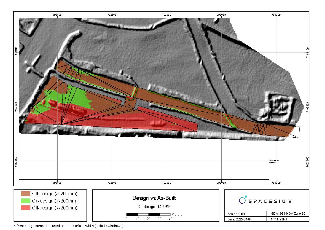
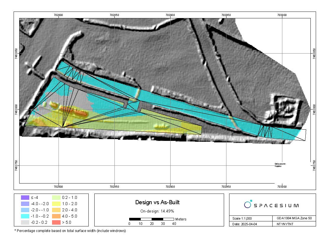
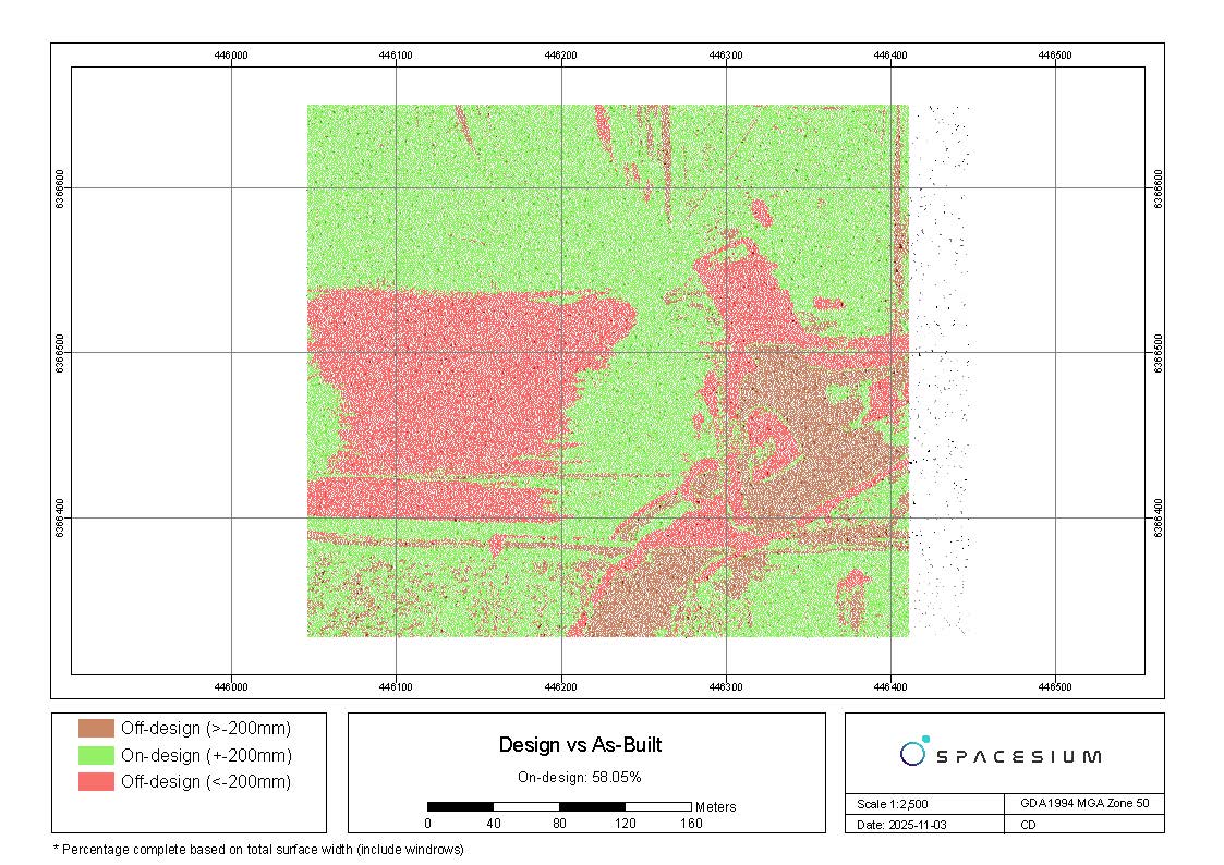
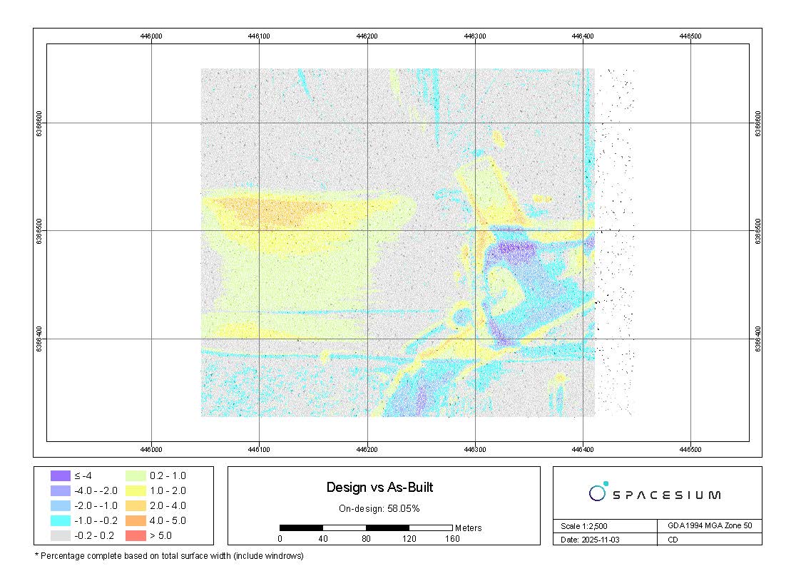
How Lidar and design is handled - whether through TIN (Triangulated Irregular Network), DEM (Digital Elevation Model), contour generation, sampling, or thinning and comparing it to designs —can significantly impact its final reporting maps. For instance - a QC requirement for all TINs are to be 0.5m with designs at a higher resolution. We always need to ensure there is a suitable resolution in the workflow to preserve the necessary precision in the final reporting.
The Critical Step: Survey data against Engineering Design
Before using our design to as-built software, simple validation of software is required to ensure both datasets are comparing equally to each other.
- Set Up Survey georeferenced systems
Establish a foundation on where all the data fits on earth. That is ensure we are all working on the same datum and projection systems.
2. Conduct Supplemental Surveys
LiDAR scans is powerful when you have a base layer then complementary scans are run over different times. This allows for not just change from design but change from actual.
3. Verify Data Accuracy
Check for consistent elevation or positional shifts. This is always the responsibility of the surveyor in charge. Garbage in garbage out.
4. Fill in LiDAR Gaps
We have build our own software to process LiDAR point clouds so the outputs are not just accurate, but consistent. The beauty of this process allow for a non-biased hands-off approach to classification.
5. Report Map key changes
There are always different metrics to compare multiple surfaces to CAD designs. For example, some users may need 200m +- differences, while others require 0.5m.
6. Automate the process
Automated reporting allows for the creation of Maps of construction layouts with flags and compare elevations against the LiDAR model to confirm acceptability. This is automated for simple inputs but fast outputs!
Final Thoughts
While LiDAR offers incredible efficiency and detail, its effectiveness hinges on proper processing. By following these steps, engineers, planners and geospatial experts can confidently integrate LiDAR into their projects while ensuring accuracy and reliability.
These tools are part of our ESRI ArcPro toolbox - you can see more here - https://www.spacesium.com/blog/How-to-use-drones-for-road-monitoring
Contact Us
Ready to explore the benefits of LiDAR drone surveying for your project?
Contact the team at Spacesium today to learn more about our services and how we can help you achieve your objectives at info@spacesium.com or you can access a demo here
🌐💡 For all the upcoming and current features, they can be accessed here.