Release Notes: April 2025. See what's new at Spacesium Scout 3D 🛰️
April 22, 2025

We have focused on streamlining the process with our latest release of Spacesium Scout 3D (Version 1.8.6.1) 🌐. Main features developed in the last month was the focus on reporting and integration into various software packages.
Major Feature Updates
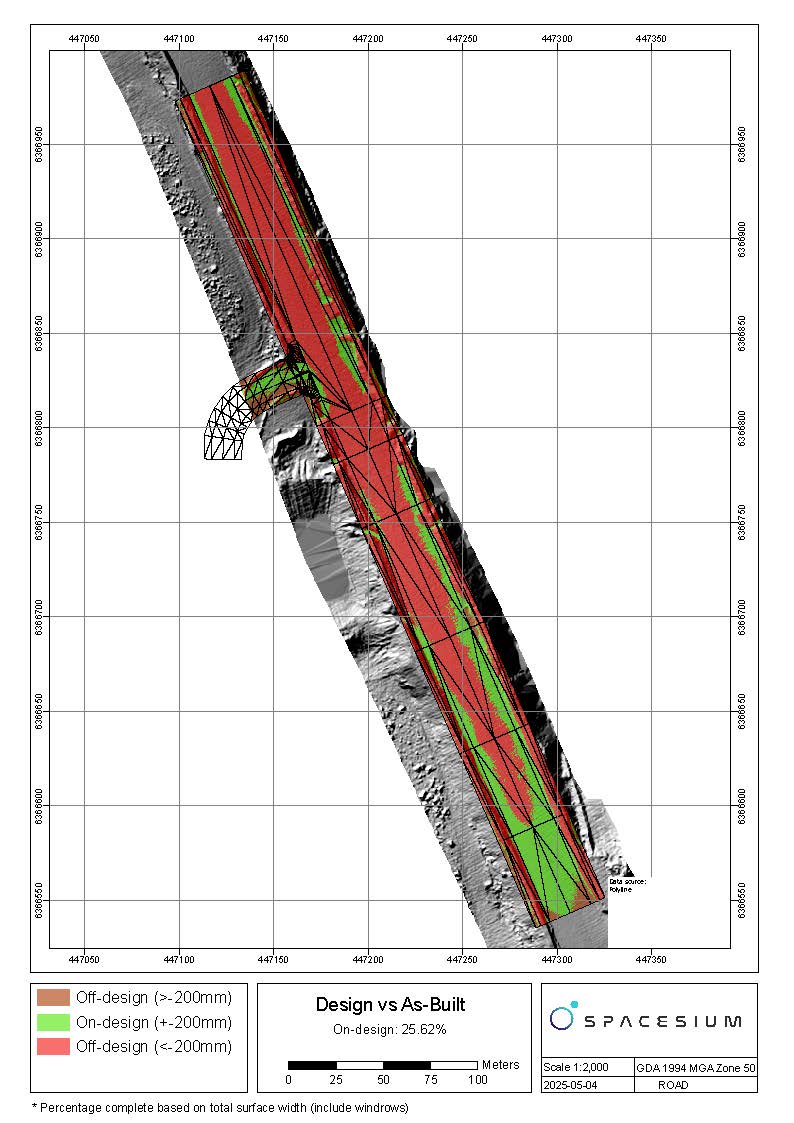
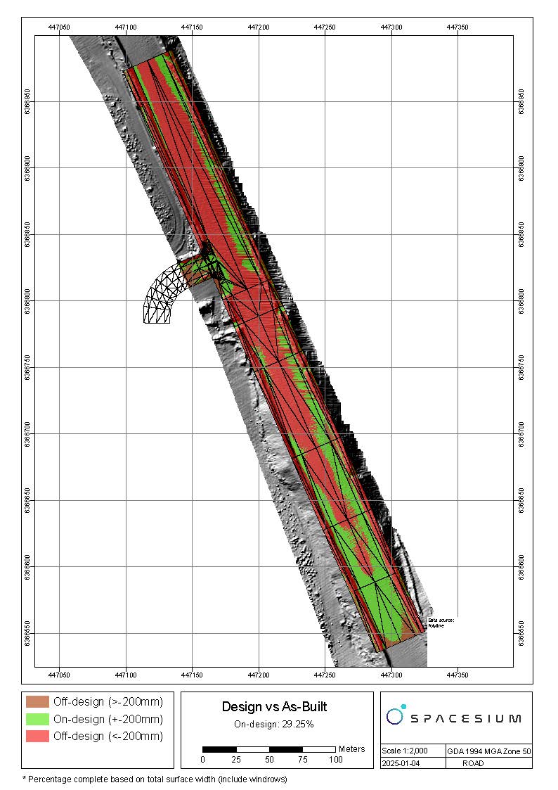
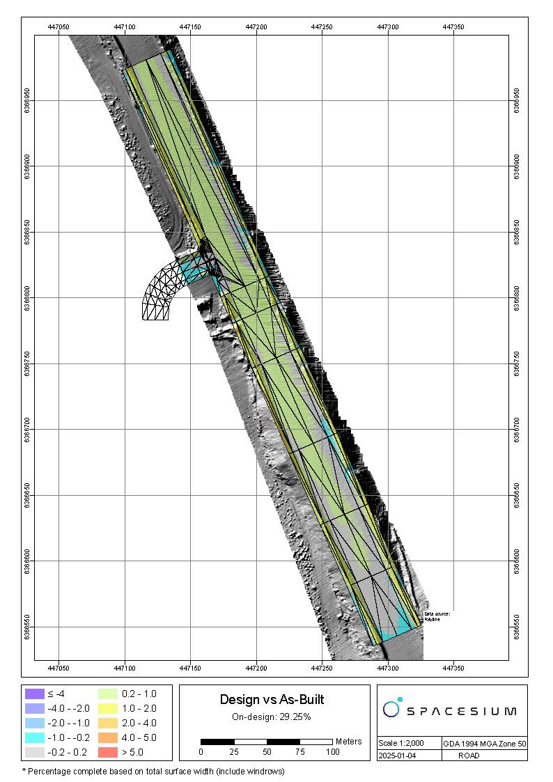
- Change Detection Analysis Reporting
Goals
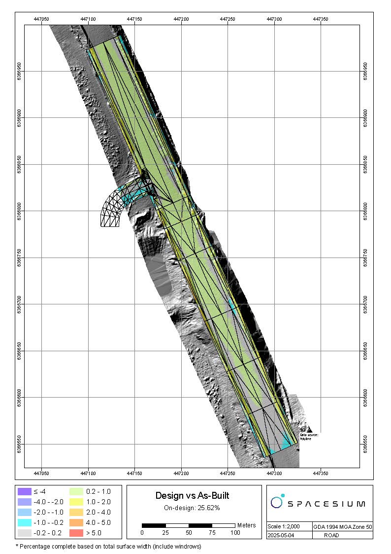
The change detection feature enables comparing two surfaces visually and in reports. Changes are detected in the Z component. It is based on the diff model concept. It is a model created by the Spacesium team to compare the differences between either scan 1 versus scan 2 or any scan versus the engineering design.
Input
Two models (1st model is the point cloud (LAS, LAZ) and 2nd model is either scan or design (LAZ, LAS and or DXF, ESRI Shape files)
Output Point clouds with the color changes draped over both point clouds and now a PDF report of the various changes.
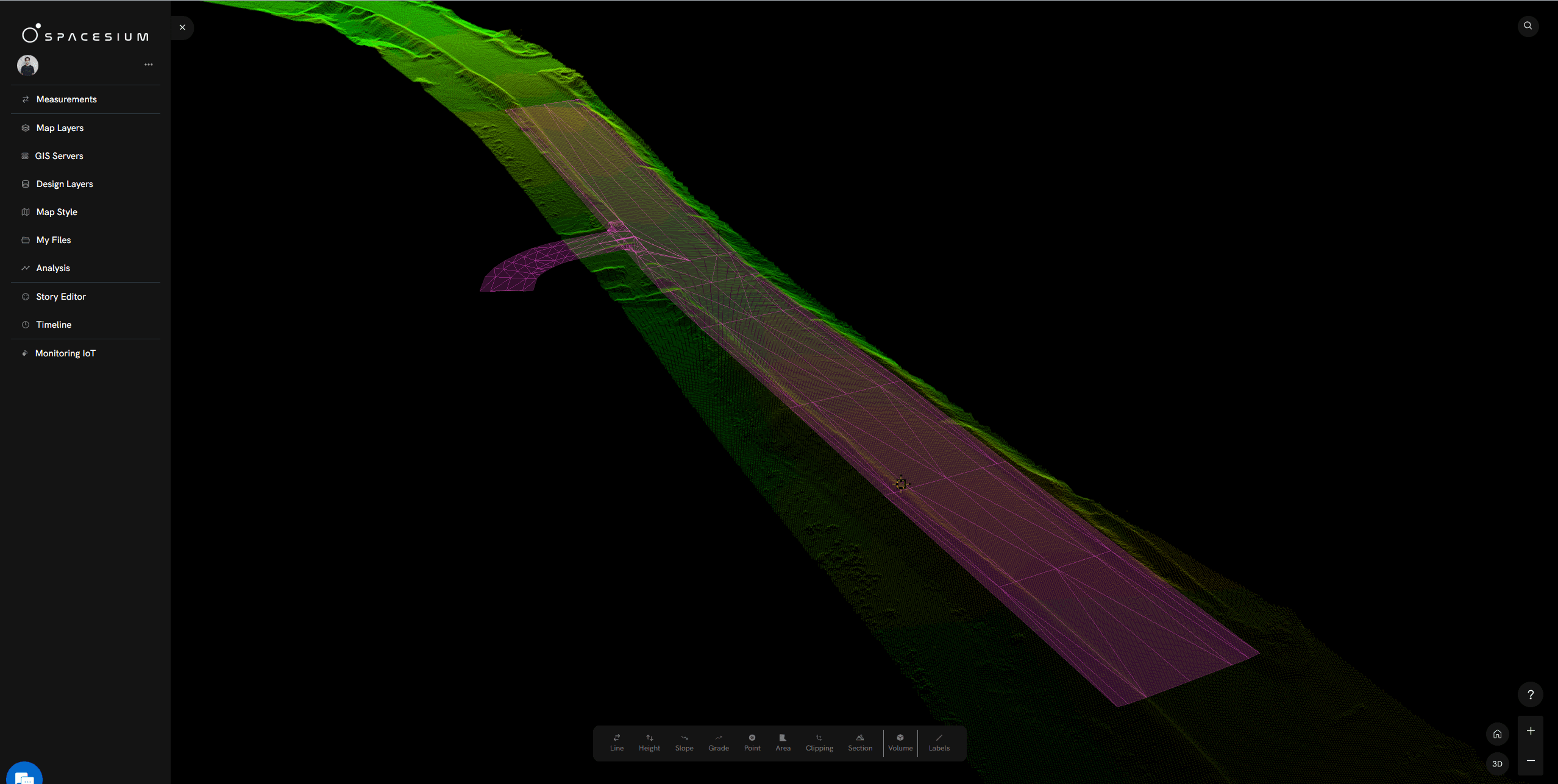
- Spacesium Road Safety Compliance Toolbox (RSCT)
In Scout 3D, Developed in collaboration with industry leaders such as Hitachi Construction Machinery Australia (HCMA), RSCT builds upon autonomous truck systems that utilize 3D point clouds from LiDAR and photogrammetry scans. Taking this technology further, RSCT introduces groundbreaking advancements in Drivable Area Segmentation (DAS), making it the first tool of its kind to integrate automated road safety compliance monitoring with geospatial data analysis. This allows mining companies to monitor and assess both road performance and road safety compliance (RSC) in near real-time across Australian and global mine sites.
- Automated Road Width Measurements – Perpendicular measurements ensure adherence to design parameters.
- Grade and Curvature Analysis – Identifies areas needing adjustment for optimal safety.
- Barrier Compliance Verification – Ensures proper placement and regulation adherence.
- Water Flow & Flood Modelling – Helps mitigate risks associated with extreme weather events.
- Deviation Detection – Highlights discrepancies between actual road conditions and design specifications.
- Change detection against design and as-built (beta)
For more details here - https://www.spacesium.com/blog/How-to-use-drones-for-road-monitoring

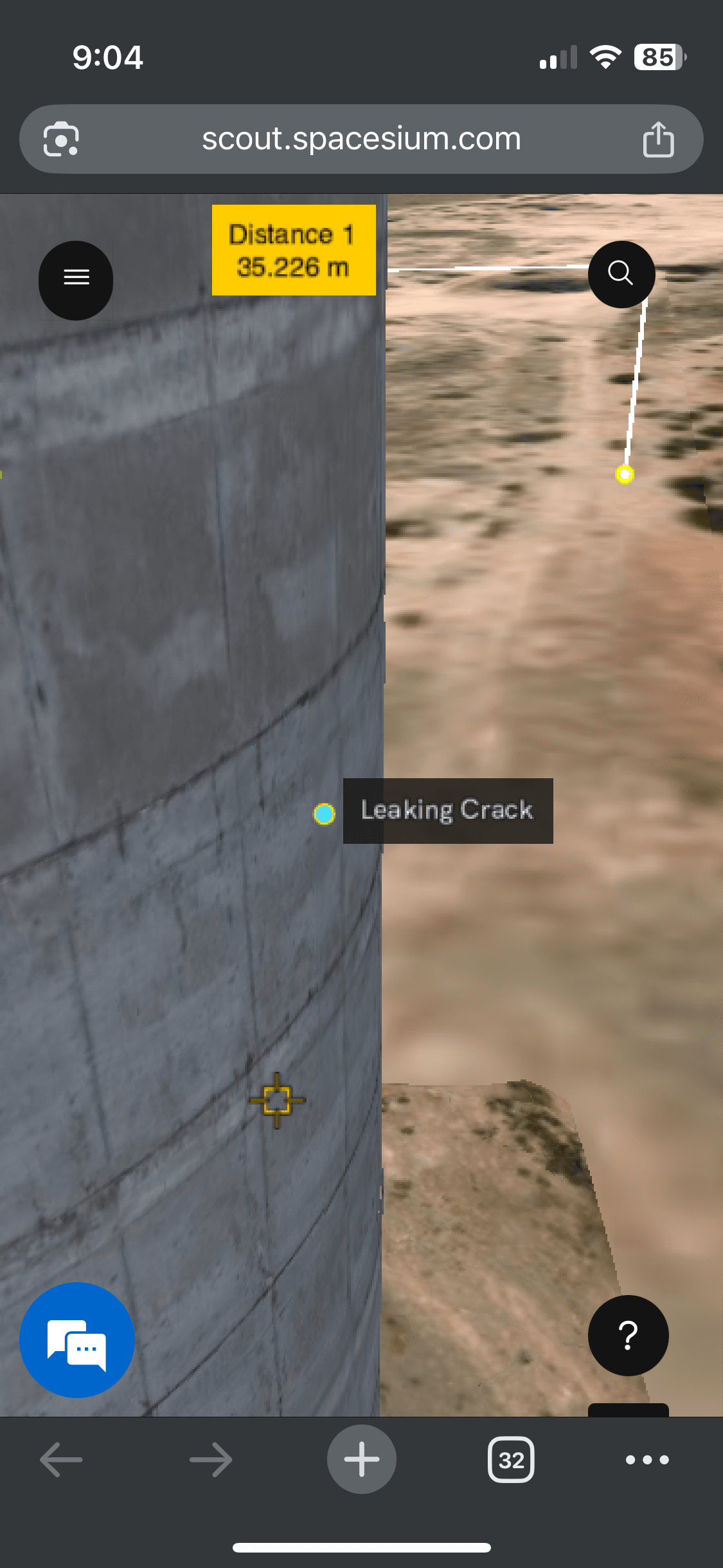
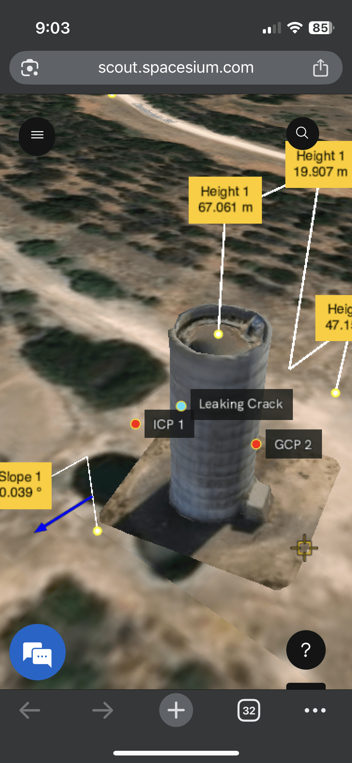
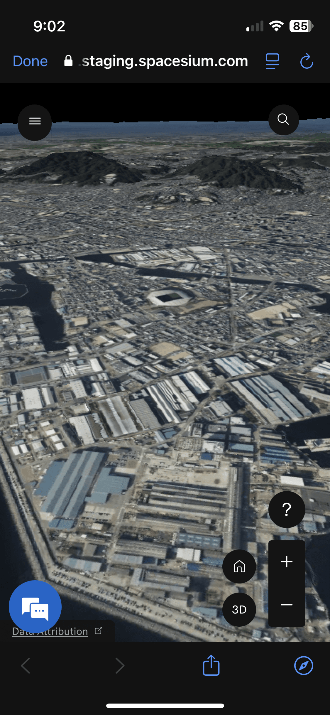
Projects Maps on mobile devices
Maps in Spacesium Scout 3D are very portable and convenient – maps work anytime, anywhere, and on any device. Scout 3D now supports different types of map layers, published in various mobile systems, that are on either the mobile or tablet platforms. Projects and map content can be shared, published, and distributed by our platform.
Fixes
- -Add new folder within Team and Projects
- -Mobile app viewing navigation
- -View point cloud by classification and color selection
- -Navigation bar fix for mobile
- -Point file fix - Can now import ESRI shapefiles as points
- -Share file fix - can view external projects without signup
- -Added EPSG fix - files for design files can be used with EPSG codes
- -Saving Map Style - basemap will be saved automatically
The decisions are up to you to build a digital infrastructure with industry experts - that have both knowledge of geospatial and software development! Try it now! https://scout.spacesium.com/create-account