Spacesium is now officially part of the MathWorks Connections Program
April 28, 2025

Software development for processing 3D point clouds from lidar and photogrammetry data in partnership with Mathworks
Highlights
- Geospatial data processing – Handling GIS assets, including raster, imagery, and CAD data
- Automated 3D point cloud processing – Analyzing large datasets from lidar and photogrammetry
- Data acquisition and analysis – Using lidar and photogrammetry for accurate geospatial mapping
- Industry expertise – Experience in agriculture technology, forestry, mining, GIS, autonomous driving, and surveying
- AI-powered algorithm development – Leveraging deep learning and machine learning to enhance processing accuracy
Spacesium processes and analyzes 3D point cloud data collected through lidar and photogrammetry using software that automates complex tasks and helps industries like forestry, mining, agriculture, surveying, and infrastructure management. With MathWorks products, Spacesium implements deep learning and machine learning to create advanced algorithms that turn raw data into valuable insights.
Automated Tree Segmentation from Lidar and Photogrammetry
Using drone-mounted and airborne lidar, Spacesium automatically identifies and measures trees, estimating locations, counts, and heights. This technology supports forest management, carbon tracking, mining, and environmental restoration projects.

Power Line and Vegetation Detection from 3D Point Clouds
Spacesium uses AI-driven algorithms that extract power lines and vegetation from 3D point cloud data and analyze clearance distances. This automation enhances power line management, reducing manual efforts and improving safety compliance.

Automated Road Safety Compliance Analysis
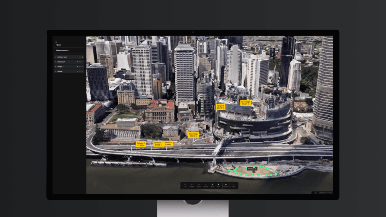
Spacesium develops advanced algorithms to assess road design, construction, and maintenance compliance. Using GIS and MATLAB, Spacesium technology detects road width, elevation, super-elevation, gradient, crossfall, water flow paths, and potential flood zones, enhancing safety in urban and rural infrastructure.

Change Detection and Surface Analysis
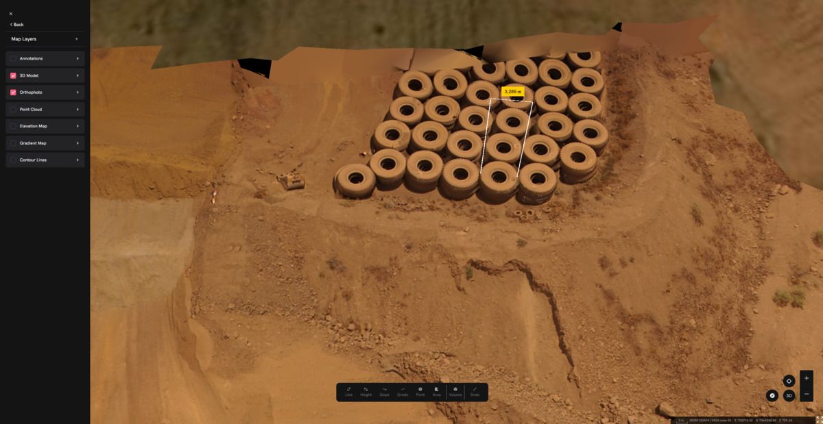
The proprietary algorithms from Spacesium detect external defects and volumetric changes in 3D point clouds. This technology is valuable for monitoring construction progress, land deformation, infrastructure wear, and environmental changes.
With over 20 years of industry experience, Spacesium builds software to transform complex 3D geospatial data into actionable insights, enabling industries to save time, improve accuracy, and automate workflows through AI-driven processing solutions.

See how engineers at Spacesium use MATLAB products or visit the Spacesium website.
The MathWorks Connections Program includes commercially offered products and services that complement MATLAB® and Simulink®.
- Software and hardware products from independent, third-party providers, which are sold and supported by the partners
- Training, consulting, and system integration services provided by partners with expertise in MathWorks products